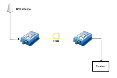
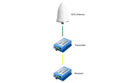
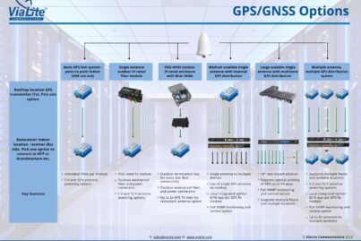
How to Extend an Antenna Cable with GPS over Fiber Technology
In the context of providing indoor GPS, the length of a coaxial cable generally is limited to around 100 meters, due to the effects of attenuation and increased noise. Even a well-screened, low loss coaxial cable can be affected by EMI, causing delays and data packet corruption. By comparison, the distance from antenna to receiver can be up to 10 km over single mode fiber.
Read more »